Building Slumprutt: A Random Route Generator in Under an Hour
I've wanted a random route generator for awhile now. My problem is I walk and bike the same routes over and over. My brain goes on autopilot. I wanted something that would throw me new routes to explore in my own neighborhood.
I wanted something simple: "Give me a random 5-mile loop from my house."
So I built it. With Claude Code's help, we went from idea to working app in under an hour.
The Name
"Slumprutt" comes from Swedish "slumpmässig rutt" (slumpmässig = random or by chance, rutt = route), commonly shortened to just "slumprutt". Seemed fitting for a random route generator.
The Stack
Backend: TypeScript + Node.js + Express
Frontend: Svelte + TypeScript + Leaflet
Routing: OSRM (Open Source Routing Machine)
Maps: OpenStreetMap
OSRM deserves special mention. It's a free public API that provides road-accurate routing with turn-by-turn directions. Incredibly fast (sub-second response times) and requires zero setup. Just hit their public endpoint and get back real routes that follow actual roads.
The Algorithm
The core challenge was generating interesting random loops. Not just random waypoints, but routes that actually feel like purposeful walks or bike rides.
Here's what I landed on:
export function generateLoopWaypoints(
  start: Coordinate,
  targetDistanceKm: number,
  variationIndex: number = 0
): Coordinate[] {
  // Use fewer waypoints (3-5) for longer segments
  const numWaypoints = Math.max(3, Math.min(5, 3 + variationIndex));

  // Reduced multiplier to 0.6 to account for road routing overhead
  const baseRadius = targetDistanceKm / (2 * Math.PI) * 0.6;

  const waypoints: Coordinate[] = [];
  const latPerKm = 1 / 111; // 1 degree latitude ≈ 111km
  const lonPerKm = 1 / (111 * Math.cos((start.lat * Math.PI) / 180));

  // Rotate each route by 120° to avoid overlap
  const primaryDirection = (variationIndex * (2 * Math.PI)) / 3;

  for (let i = 0; i < numWaypoints; i++) {
    const baseAngle = (i / numWaypoints) * 2 * Math.PI + primaryDirection;
    // More randomness for diverse paths
    const angleVariation = (Math.random() - 0.5) * 0.8;
    const angle = baseAngle + angleVariation;
    // More radius variation to explore different distances
    const radiusVariation = 0.5 + Math.random() * 1.0;
    const radius = baseRadius * radiusVariation;

    waypoints.push({
      lat: start.lat + Math.sin(angle) * radius * latPerKm,
      lon: start.lon + Math.cos(angle) * radius * lonPerKm,
    });
  }

  return waypoints;
}
Key design decisions:
-
Fewer waypoints (3-5 instead of 8+) means longer road segments and more interesting routes. Too many waypoints and you just walk back and forth.
-
Smaller radius with overhead adjustment (0.6x) accounts for the fact that road routing adds significant distance compared to straight-line waypoints. Initially used 1.5x which resulted in 7-8 mile routes when requesting 1 mile.
-
Directional rotation (120° per route) prevents all routes from heading in the same direction. Generate 3 routes and they'll spread out into different quadrants.
-
More randomness (0.8 angle variation, 0.5-1.5 radius variation) creates diverse paths that explore different areas. This prevents multiple routes from clustering in the same locations.
Then we feed those waypoints to OSRM, which turns them into actual road routes with turn-by-turn directions.
Challenges
Distance Input Validation
First issue: weird validation errors when changing distance inputs. I had
step="0.1" on both the miles and kilometers inputs. The problem:
3.2 miles converts to 5.1494888 km, which rounds to 5.15. The browser
expected 5.1 or 5.2 (multiples of 0.1) and rejected 5.15.
Fix: step="any" accepts any decimal value.
Map Not Visible
Built the whole UI, ran it, and... no map. Just an empty space where the map should be.
The issue: CSS height inheritance. The map div had height: 100% but its
parent containers didn't have explicit heights. The fix required setting
height on three elements:
:global(html),
:global(body),
:global(#app) {
  height: 100%;
  width: 100%;
}
This is a common Svelte gotcha when you want a full-viewport layout.
Routes Don't Follow Roads
Initial implementation drew straight lines between waypoints. Routes went through buildings, parks, water. Not useful for actual navigation.
This is where OSRM saved the day. One API call with waypoints, get back actual road geometry:
const coords = route.points.map(p => `${p.lon},${p.lat}`).join(';');
const url = `https://router.project-osrm.org/route/v1/${profile}/${coords}?overview=full&geometries=geojson&steps=true`;

const response = await fetch(url);
const data = await response.json();
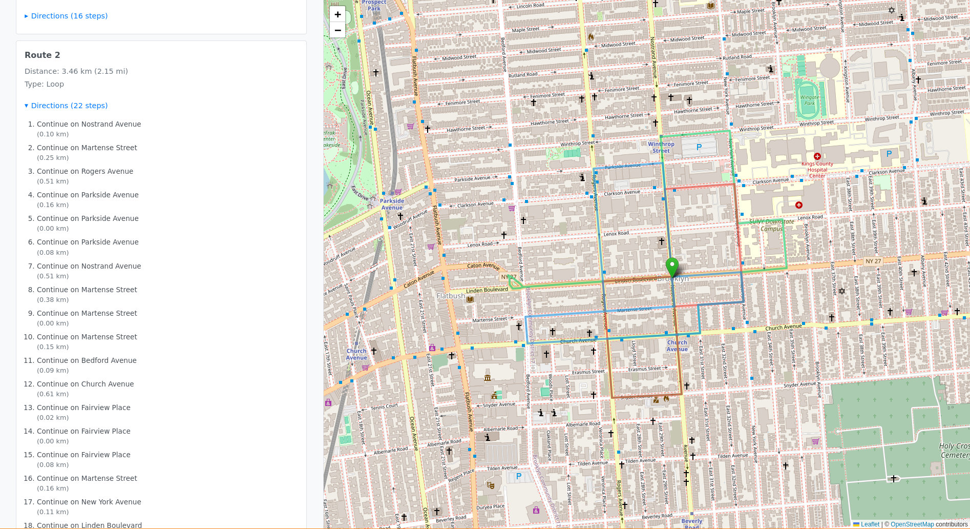
The steps=true parameter gives you turn-by-turn directions too, which
I added to the UI in collapsible sections under each route.
Boring Back-and-Forth Routes
First test: "Walk this way, turn around, walk back." Technically a loop, but boring as hell.
The issue was too many waypoints creating short segments. The fix was the algorithm changes I mentioned earlier: fewer waypoints, larger radius, directional rotation. Now routes actually explore different areas instead of just oscillating.
TypeScript Across the Stack
I initially questioned whether TypeScript was overkill for this project. Turns out it was perfect.
Shared types between frontend and backend caught so many potential bugs:
export interface Coordinate {
  lat: number;
  lon: number;
}

export interface GeneratedRoute {
  id: number;
  points: Coordinate[];
  waypoints: Coordinate[];
  isLoop: boolean;
  distance?: number;
  duration?: number;
  steps?: RouteStep[];
}
When the backend returns GeneratedRoute[], the frontend knows exactly
what shape to expect. No guessing, no runtime surprises.
Development Environment
Created a Nix shell for reproducible development:
{ pkgs ? import <nixpkgs> {} }:

pkgs.mkShell {
  buildInputs = with pkgs; [
    nodejs_22
    typescript
    nodePackages.tsx
  ];
}
Anyone can clone the repo, run nix-shell, and have the exact same
environment. No "works on my machine" issues.
Result
The app works. You enter an address, pick a mode (walk/bike/car), set a distance, and hit generate. It shows you multiple random routes on an interactive map with turn-by-turn directions.
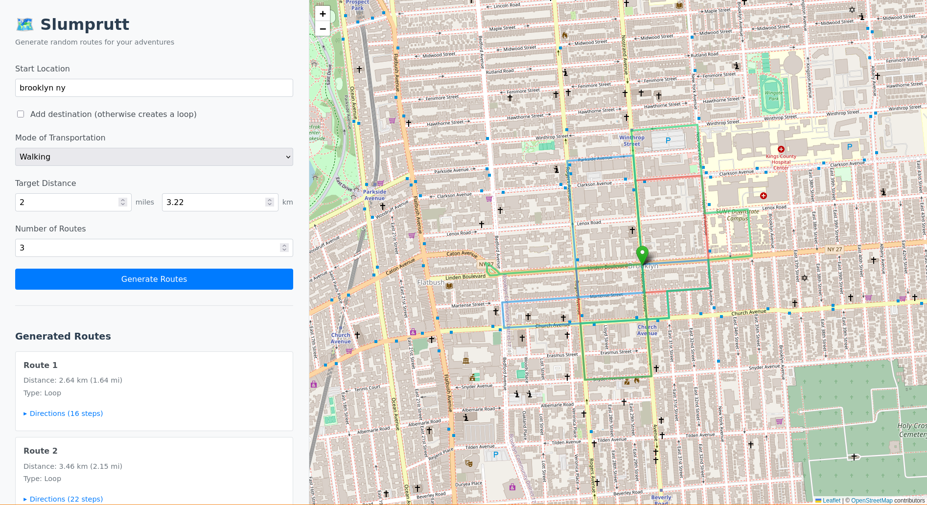
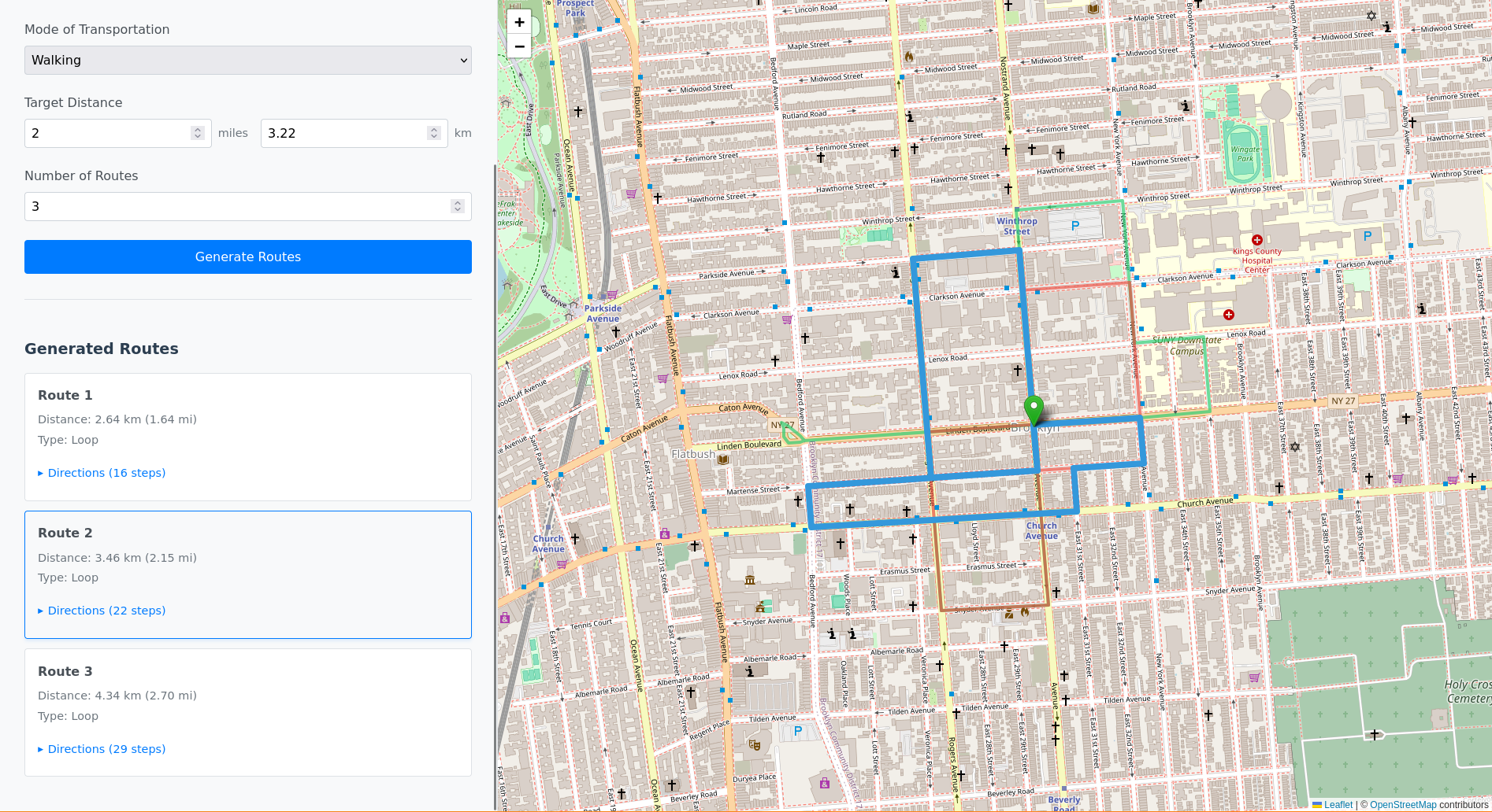
I've already used it to find new walking routes in my neighborhood.
Is it perfect? No, it's not. You will get routes that go down sketchy roads or routes that still go back and forth. But it was fun and it's helpful to me.
Try it yourself: github.com/ducks/slumprutt
What I Learned
-
OSRM is incredible - Free, fast, accurate. No API key required. If you're building anything with routing, use OSRM.
-
TypeScript prevents so many bugs - Especially for coordinate/route data that flows through multiple layers. Type errors at compile time beat runtime errors every time.
-
Fewer waypoints make better routes - Counterintuitive, but 3-5 waypoints create more interesting loops than 8-10.
-
Svelte's reactivity is clean - No useState/useEffect boilerplate. Just
$: if (condition) { doThing() }and it works. -
Building with AI is wild - Went from idea to working app in under an hour. Not just scaffolding, but a fully functional app with an interesting algorithm, API integration, and polished UI.